Communities along hundreds of miles of Alaska’s coastline are preparing for what forecasters say could be a record-breaking storm as the remnants of Typhoon Halong approach. National Weather Service forecasters say conditions are expected to deteriorate quickly Saturday evening, especially south of the Seward Peninsula, as the storm rapidly strengthens, bringing with it surging seas and powerful winds.
The National Weather Service has issued flood warnings for communities from the Kuskokwim River to Wainwright on the North Slope, and high wind warnings that stretch as far north as Kivalina.
“Areas south of the Bering Strait are anticipated to receive potentially catastrophic coastal flooding, while areas further north receive severe impacts” that could compound the damage from a storm earlier this week, the National Weather Service said.
The remnants of Typhoon Halong crossed into the Bering Sea Saturday morning, said Rick Thoman with the Alaska Center for Climate Assessment and Preparedness. The storm is likely to move north of St. Paul Island by midnight and near Nome before dawn Sunday, he said.
“It is moving at a pretty good clip,” Thoman said. “That means winds and the seas are going to ramp up pretty rapidly. Of course, it'll be happening soonest in the, say, the (Yukon-Kuskokwim) Delta area, and then a few hours later, farther north into Norton Sound.”
The storm presents a dual threat of high winds and coastal flooding, Thoman said, though the exact track is uncertain, due in part to a lack of weather balloon readings from St. Paul Island and Kotzebue.
“There's been big differences in the timing and intensity to this storm,” he said. “So this is very much a case where we want to prepare for the worst and hope for the best.”
The first area to feel the brunt of the storm will be the Pribilof Islands, where winds could reach hurricane force overnight and into Sunday, pushing seas to 25 to 30 feet by Sunday morning.
On Sunday, the center of the storm is set to move northward, bringing gusts of up to 90 miles per hour to the Y-K Delta communities of Mekoryuk, Toksook Bay and Tununak throughout the day. Water levels are also forecast to rise throughout the day Sunday and may remain high into Monday morning.
A little farther north, along the coastline from Hooper Bay to Nunam Iqua, wind gusts could approach 100 miles per hour for six to 12 hours, according to the National Weather Service.

High winds will push seawater inland, leading to storm surge. Forecasters expect waters to reach six to 14 feet above the normal highest tide line on the Yukon and Kuskokwim Delta coasts and along Norton Sound, including Unalakleet, Shaktoolik and Koyuk. The storm surge is also expected to lead to minor flooding along the Kuskokwim River.
The forecast for Bethel, which is farther inland, calls for 60 mile-per-hour gusts Saturday night and minor flooding in low-lying areas that could extend into Monday.
Then, the storm will keep moving.
“In most places, this will be a six- to 12-hour period of high waters and really high winds. But then after that, things should calm down quite a bit,” Thoman said. “Overall, this is not going to be a long-duration storm the way that some Bering Sea storms are.”
While it will not be long, it will be strong.
In fact, National Weather Service forecasters said it “may be the strongest storm to hit the west coast of Alaska since Ex-Typhoon Merbok,” which caused severe damage to Western Alaska in 2022.
Halong follows another storm earlier this week that led to flooding in Northwest Arctic communities including Kotzebue, Kivalina, Noatak and Deering. Thoman said he expects Halong to bring a higher storm surge in the Y-K Delta and Norton Sound than the previous storm and lower water levels in Kotzebue and Shishmaref north of the Bering Strait.
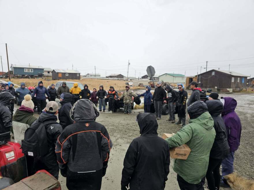
Meanwhile, residents along the coast on Saturday braced for impact.
In Shaktoolik, on the eastern shore of Norton Sound, some residents evacuated to Unalakleet by boat and chartered planes.
In Hooper Bay, residents prepared for possible evacuations.
Multiple village police officers and volunteers were stationed at points around the community, and several boats were staged on the north side of town for residents who might need to reach evacuation points.
An agent for air carrier Yute Commuter Service confirmed that at least one plane was being sent on Saturday afternoon from Bethel to shuttle Elders and single mothers with children to the nearby community of Chevak, where storm impacts might be less severe.
To the north, in Nome, some business owners boarded up their windows and residents rushed to secure loose items.
On St. Lawrence Island out in the Bering Sea, teacher Shem Rose Koonooka said residents planned to ride out the storm at home.
“We've had this for hundreds of years, as far as I can remember,” she said. “We’re not scared.”
KNOM's Ben Townsend and KYUK's Samantha Watson contributed reporting.


